Zamość 1920-22 Map Project Home Page
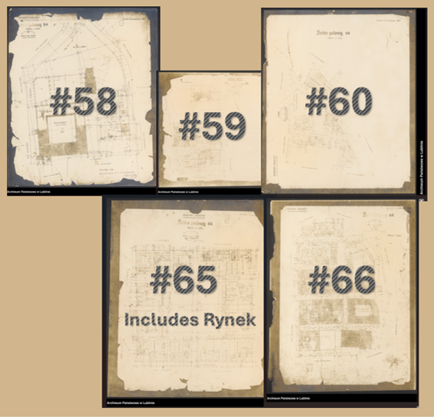
This cadastral map is the central Rynek (market square) section of a 12 part field sketch of the Town of Zamość drawn during 1920-22 that includes the property owners’ names. Of the 12 parts, 5 included Jewish names and so we are including those 5 continguous parts in this project. To visit the interactive maps, click on one of the five maps pictured below.
The other parts of the composite map can be reached by clicking on the spot on the edges of each map that correspond to Sketches #58, 59, 60, 65 and 66 or by returning to this home page. The relationship of the five parts is similar to the shape of the 5 rings of the international Olympics symbol with 58, 59 and 60 on the top row, and maps 65 and 66 appearing in a second row, but touching two of the maps in the top row.
These maps were found in the Lublin branch of the Polish State Archives and are in the public domain. They can be found on the PSA’s website at: 35/636/0/-/850-861.
